Satellite images have always been my favourites. Now I’ve got a way to get all I want. And what beter way to start than with MasjidulHaraam and Masjidun Nabi?
I’ll give you a brief introduction to the images. Click on a thumbnail to view larger version of the image.
Makkah Mukarramah
 |
 |
 |
 |
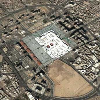
The first image is from around 17mi elevation of the eye. This just gives the feel of the place as you can’t see much besides the Holy Mosque itself.
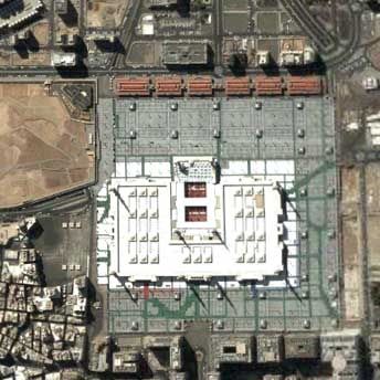
The second image is from around 40,000 ft high. I just couldn’t go any closer without loss of quality. It’s a pity really because all holiness aside, the place is beautiful!
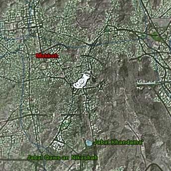
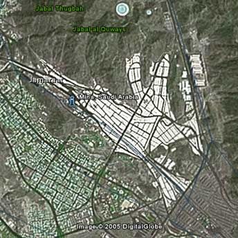
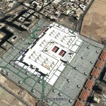
Third image is of ‘Mina’ - the tent village used during Hajj (pilgrimage). The whites you see in the image are tops of the tents. It’s spans many square miles and during the days of Hajj, you wouldn’t see anything but heads bobbing up and down as people walk from one end to the other (South East to North West).
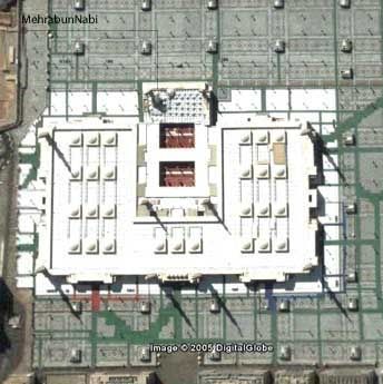
The last image is of the sacred grounds of Arafa.
Madina Munawarrah
 |
 |
 |
 |
 |
 |
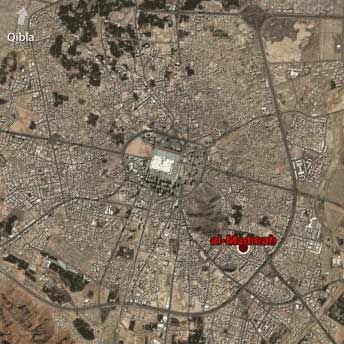
The first image is, again, a bird’s eye view. Notice how the whole city sort of diverges towards the Prophet’s Mosque (Sallalahu alaihe Wasallam, may peace be upon him)
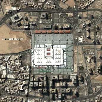
The second image is of the Prophet’s Mosque (Sallalahu alaihe Wasallam). To the left, you can see Jannatul-Baqee’ - the graveyard where many of the sahaba (Radhiallahu Anhum)and many many scholars and leaders are buried.
Third, fourth and fifth are other views of the mosque. You really have to be there to appreciate the true beauty of the place though. I’m just glad I could get better pictures here.
The last one shows a close-up of the mosque. To the top-left is ‘Gumbad-e-Khazra’ (that’s ‘the green dome’), the resting place of the Holy Prophet Muhammad (Salallaho Alaihe Wasallam).